Whether you are skilled hiker looking for steep challenges, recreational tourist seeking for accessible views or a leisure spectator of natural beauty who prefers flat terrain, Jotunheimen National Park offers possibilities for all of you.
Galdhøppigen (2 464 m)
- Distance: 6 km (one way), 6 km back by the same path
- Duration: 2 h (one way)
- Terrain: rocky, not demanding
- Starting point: Spiterstulen – parking lot by mountain cabin
Jotunheimen (eng. Land of Giants) is home to the highest mountains in Norway, with the top one Galdhøppigen. The hike is not demanding as you might expect. There are three ways to the top with various difficulties. We write about the easiest one.
After the first two steep kilometres, views open towards Visdalen valley or Spitehoe mountain. After passing the ridge under the top, there is a need to pass several meters of a glacier, but no special equipment is necessary. At the peak buy yourself energizing chocolate bar in DNT cabin and enjoy the views!
Tip – Enjoy hot shower after the hike in Spiterstulen cabin (free of charge)!

Besseggen Ridge (1 743m)
- Distance: 14 km (one way), 10 km by lake Gjende
- Duration: 6-7 h (one way)
- Terrain: rocky and sometimes steep
- Starting point: Gjendesheim (ferry or walk)
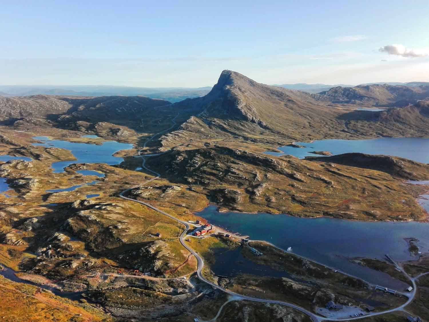
One of the world´s best hiking tours according to National Geographic is visited each summer by 30k visitors. Deservedly, because the view on the ridge that prevents Bessvatnet lake from draining into lake Gjende – 400 vertical meters below is breathtaking!
Besseggen connects Gjendesheim and Memurubu villages and it’s up to you which one will be your starting point for the hike. Any you choose, park your camper in Gjendesheim.
The most popular tactic is to catch the morning ferry from Gjendesheim to Memurubu and then hike back. Our tactic was to start hiking from Gjendesheim and take the ferry back. Because it’s not the usual way, most hikers will hike the opposite way as you. It’s not a problem until the “climbing point” where you have to wait until others pass.
You can refill your bottle with water from, as it’s said, the clearest lake in whole Norway – Bessvatnet.
Tip! – Why is renting a camper the best option for your road-trip in Norway
Memurubu → Gjendesheim
Pros: You don’t have to worry about time to catch the ferry.
Cons: You are not going to be the only one on the ferry, which means you will start your hike together with other tens of people.
The view is behind you.
Gjendesheim → Memurubu
Pros: The best view is in your sight, not in your back.
Cons: Most of the people hiking the opposite way, but the path is wide enough for everyone.
Ferry schedules may be found here. They operate from June until October but double-check the dates mainly at the beginning and end of the season.

Knutshø (1 517 m)
- Distance: 6 km (one way), 6 km back by lake ØvreLeirungen and it’s rivers
- Duration: 2 h (one way)
- Terrain: Two sections require gripping with hands
- Starting point: Free parking lot by the main road
Knutshø is small brother to Besseggen. The views are comparable, try to spot little people on Besseggen ridge or look down to a valley with ØvreLeirungen lake. The hike is not that demanding, but there are few fake peaks as we use to call ones that only seem to be the top of the mountain.
After passing the real peak, the view opens and the noisy waterfall offers you with freshwater and cooling to your feet after the hike. You might prefer a chilly swim in the lake.
Two points, in the beginning, and at the peak, require to use your hands. Bring water with you, a refill is possible only at the end of the ridge. The trek is quite steep, so better follow the path so you don’t get stuck somewhere.
Tip – Because of thousands of mosquitos use insect repellent!

Synshorn (1 475 m)
- Distance: 3 km (one way), back by the same path
- Duration: 1-2 h (one way)
- Terrain: easy, family-friendly
- Starting point: Parking by Bygdin hotel
This little mountain that offers a beautiful 360° view towards two-thousands peaks might be your refreshing hike after a few hours of driving the campervan. It’s not demanding, the terrain is little steep in the beginning. A waterfall appears in late summer, but reindeers, you can spot them any time! So have your eyes open.
There are two most popular ways to the top. One is to hike it by well-marked path for free of charge and another one is Via Ferrata that belongs to climbing guides. Everyone in good physical shape can participate, you don’t need any previous experience or equipment. They will provide it all.
Tip – Stop by in Bygdin fjellhotell for an amazing homemade waffle with typical Norwegian brown cheese. Yummy!

If you wondered what to see in Jotunheimen National Park, we hope we answered your questions. These tips are only for a short visit because there is much more to be seen or to be done. There are plenty of opportunities in fishing, cycling or skiing in winter. Jotunheimen is home to many DNT (Norwegian tourist association) cabins so if you don´t make it in time to one of Benzini´s campers, don´t worry and spend the night there.


